The Peaks of the Balkans is a 192 km (120 mile) loop through the Accursed Mountains, crossing Albania, Kosovo, and Montenegro. Expect alpine ridges, shepherd villages, and some of the warmest hospitality in Europe. This guide covers everything you need to plan the hike - for deeper dives on specific topics, follow the links throughout.

Peaks of the Balkans in more detail
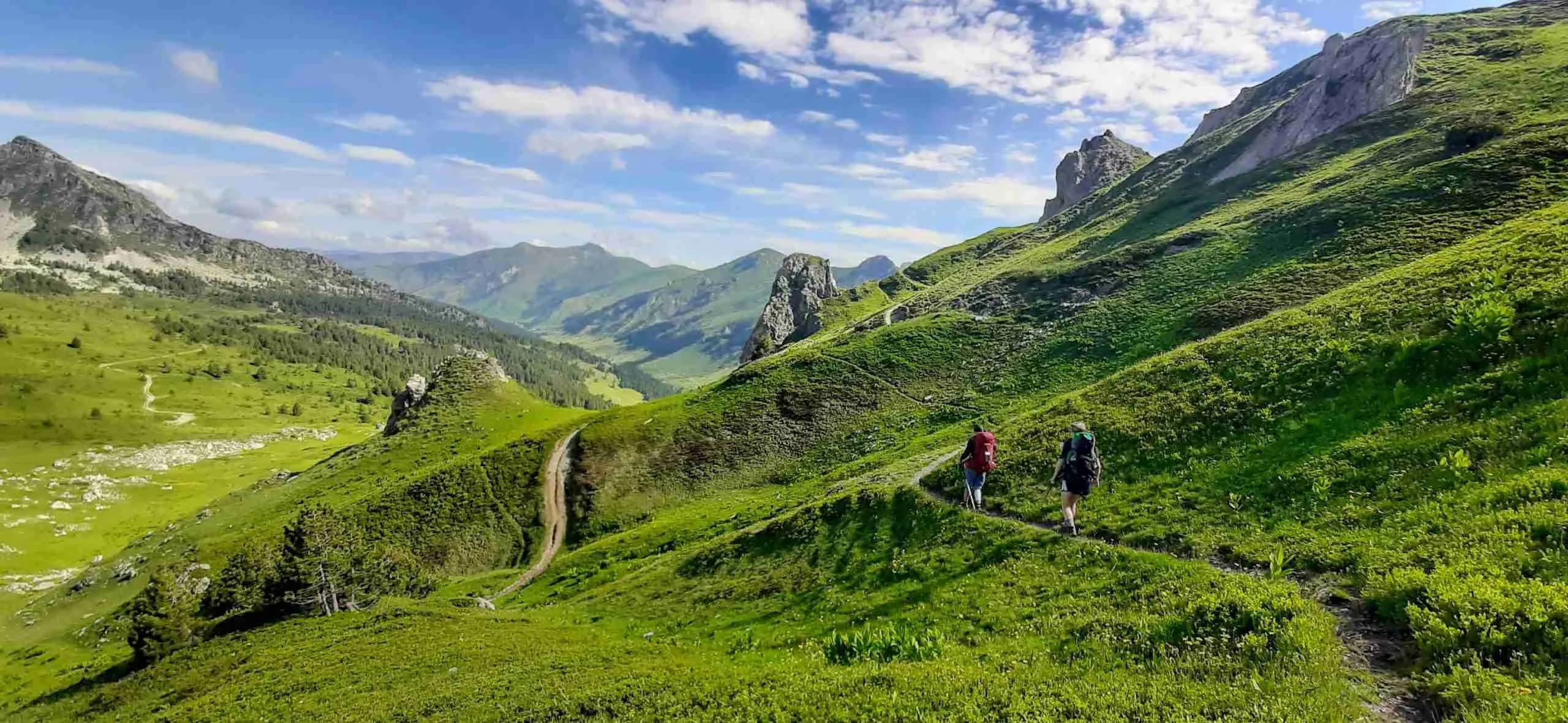
The trail is a circular route through the Prokletije range - the Accursed Mountains - linking remote valleys across three countries. Most hikers follow the classic 10-stage loop: roughly 192 km with around 11,500 m of combined elevation gain and loss. Stages run 10-28 km each and typically take 6-8 hours.
This is not a coastal stroll. You will climb serious passes (Valbona at 1,795 m, Peja at 1,711 m), cross tree lines, and walk through villages that feel a world away from modern Europe. The trade-off is culture: family-run guesthouses, home-cooked Balkan food, and fellow hikers gathered around a terrace every evening.
Where does the trail start and finish?
Because it is a loop, you can start anywhere - but Theth in Albania is the most popular entry point. Other common starts include Plav in Montenegro, Valbona in Albania, and the Rugova valley near Pejë in Kosovo. Pick whichever airport and transport route works best for you.
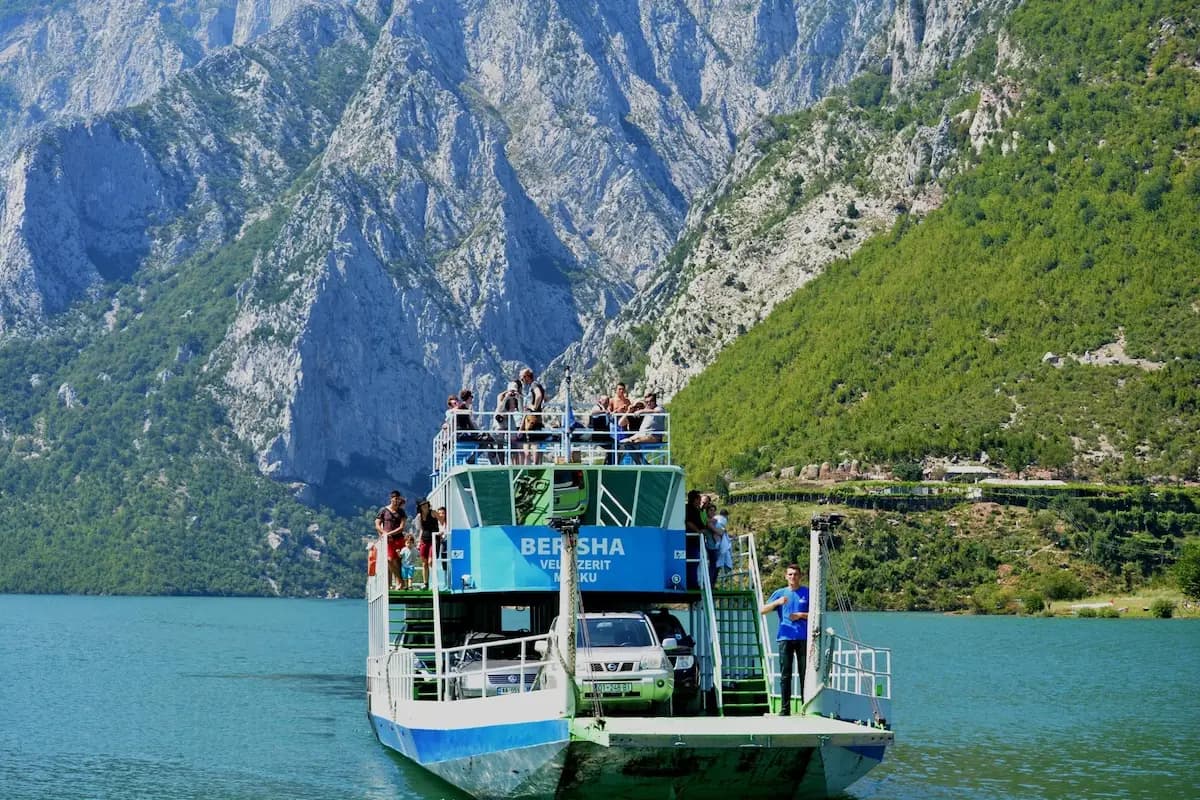
So in practice: fly into Podgorica, Tirana, or Pristina, reach your chosen trailhead, hike the loop, and return to where you started. Key stops along the way include Valbona, Çerem, Dobërdol, Milishevc, Reka e Allagës, Kuqishta, Babino Polje, Plav, Vusanje, and Theth. For full transport breakdowns - buses, ferries, taxis, and airport routes - read the getting to the trail guide.


- Theth - Valbonë (13.9 km)
- Valbonë - Çerem (19.8 km)
- Çerem - Dobërdol (15.7 km)
- Dobërdol - Milishevc (18.2 km)
- Milishevc - Reka e Allagës (16.2 km)
- Reka e Allagës - Kuqishta (23.5 km)
- Kuqishta - Babino Polje (15.8 km)
- Babino Polje - Plav (20.3 km)
- Plav - Vusanje (27.5 km)
- Vusanje - Theth (21.4 km)
How long does it take to hike?
Most people complete the loop in 10 days, following one stage per day. That is a solid pace for most fitness levels - long days on stages 4, 6, and 9 can push 8-9 hours. If you want more breathing room, add a rest day in Plav (best resupply town on the trail) or split the longest stages.
You can also compress the route into 7-8 days if you are fit and comfortable with 25+ km days. The opposite works too: stretch it to 12-14 days and take your time in the valleys. For stage-by-stage distances, elevation, and what to expect each day, see the stages guide.
Which direction should you hike?
The standard direction is counter-clockwise from Theth: Theth → Valbona → Çerem → ... → Vusanje → Theth. Most trail resources, guesthouse bookings, and hiker flow follow this order. Starting in Theth also puts the famous Valbona Pass on day one - a strong way to kick off the trip.
There is no wrong direction on a loop. If your flights land you in Plav or Kosovo, starting from there and hiking whichever way fits your logistics is perfectly fine. The main thing is to plan accommodation in the order you will actually walk.
How to get to the trail
Getting there takes more planning than your average European hike. The region has no single gateway city - you will likely combine flights, buses, minibuses, and sometimes the scenic Koman Lake ferry. Podgorica (Montenegro), Tirana (Albania), and Pristina (Kosovo) are the three main airports.
Minibuses are the backbone of Balkan transport. Guesthouses often arrange transfers, which saves a lot of hassle. Always carry some cash - euros work in Montenegro and Kosovo. The full breakdown of every entry point, with prices and travel times, is in the getting to the trail guide.

Best time of year to hike
The hiking season runs from late June to mid-September. Snow can linger on high passes into early July, and most guesthouses close from October through May. July and August bring the most stable weather but also the hottest midday temperatures in lower valleys like Plav and Valbona. Early September is quieter with cooler days - though some remote guesthouses start closing by mid-month.
Winter hiking is not recommended unless you are an experienced mountaineer with a local guide. For month-by-month detail, read when is the best time to hike.
How difficult is the hike?
On paper the trail is classified as moderate. In practice it is harder than the numbers suggest. Stages regularly exceed 1,000 m of vertical change, stage 9 is 27.5 km, and you are often above 1,500 m with exposed ridges and unpredictable weather. Fitness matters - regular hill walking before you go will make a real difference.
The trail itself is not technical. You will not need ropes or scrambling skills on the standard route. What you do need is stamina, good navigation, and respect for mountain weather. Trekking poles help on the long descents. If you are new to multi-day hiking, stick to one stage per day and book guesthouses ahead so you are not carrying heavy loads.
Can you hike it in sections?
Yes. The loop is well suited to shorter trips. Pick 3-5 consecutive stages and use buses or guesthouse transfers to get in and out. Stage 1 (Theth to Valbona) is a popular standalone hike - the Valbona Pass crossing is the most iconic single day on the trail. Plav to Vusanje is another rewarding section if you want big ridge days without committing to the full loop.
Is the trail easy to follow?
Mostly yes - the trail is marked with red and white paint blazes along the standard route. In high season, paths are well-trodden and guesthouses can point you in the right direction. That said, weather moves fast in these mountains. Fog, snow patches (even in June), and unmarked variants can catch you out.
An offline map on your phone is essential. We built Peaks of the Balkans Map for exactly this - free, works offline, and covers the full loop with guesthouses and points of interest. For a comparison of navigation and planning apps, read best apps for the Peaks of the Balkans.

Where to stay along the trail
Accommodation is almost entirely in family-run guesthouses and small hotels. Expect rustic but welcoming - home-cooked dinners, shared terraces, and hikers swapping stories over raki. A typical bed in a guesthouse runs around €40 per night; many also let you pitch a tent in the garden for roughly €12 and use the facilities.
Book ahead, especially in July and August. Capacity is limited in remote villages like Çerem and Dobërdol. Use our accommodation planner to see every option on the map and build your itinerary. For booking tips and the guesthouse vs camping decision, read accommodation on the Peaks of the Balkans. For our handpicked favourites stage by stage, see the top 10 guest houses.
Food and drink on the trail
Food is one of the highlights. Guesthouses serve generous portions of local dishes - grilled meats, stews, fresh salads, and homemade bread. Ćevapi, qofte, and flija are worth ordering at least once. Coffee is everywhere, usually Turkish style.
On the trail itself, food options are limited. Pack lunch most days and ask your guesthouse for a packed meal the night before. Towns like Plav have supermarkets for resupply. For a full food guide with must-try dishes and what to expect at mealtime, read food on the Peaks of the Balkans.

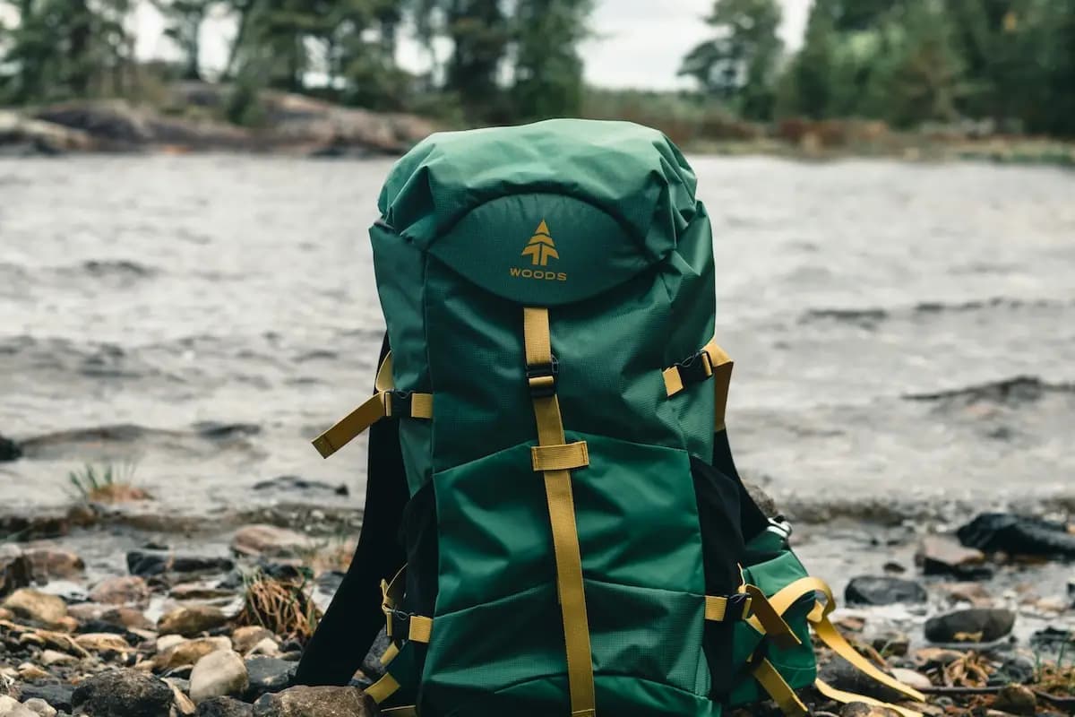
What gear to bring
What you pack depends on how you hike. Staying in guesthouses every night? You can travel light - a 30-40 L pack, trail runners or hiking shoes, layers for changeable weather, and sun protection. Planning to camp in guesthouse gardens or wild camp? You will need a tent, sleeping bag, and cooking setup on top.
The weather shifts quickly above 1,500 m. Bring a rain layer, fleece, and warm hat even in summer. Carry 2-3 litres of water on long stages - springs are not always where you need them. For the full breakdown by setup (basic, flexible, and full camping), read the packing guide. For a shorter list of essentials, see 10 must-pack items.
Guided tours and local support
You do not need a guide to hike the standard loop - thousands of hikers do it independently every year. But if the logistics feel overwhelming, a guided tour handles transport, accommodation, and navigation. Local agencies know the trail intimately and can share context on history and culture that you would miss hiking solo.
For tour provider recommendations and what to expect from a guided trip, read best tours for Peaks of the Balkans.
Key takeaways
- Hike in season: late June to mid-September
- Book accommodation in advance - capacity is limited in remote villages
- Download Peaks of the Balkans Map for offline navigation
- Pack for changeable mountain weather - layers, rain gear, and sun protection
- Plan your transport early - read the getting to the trail guide
- Say yes to guesthouse dinners - the food and company are part of the experience